How to find us
Directions to Perrydale Trails
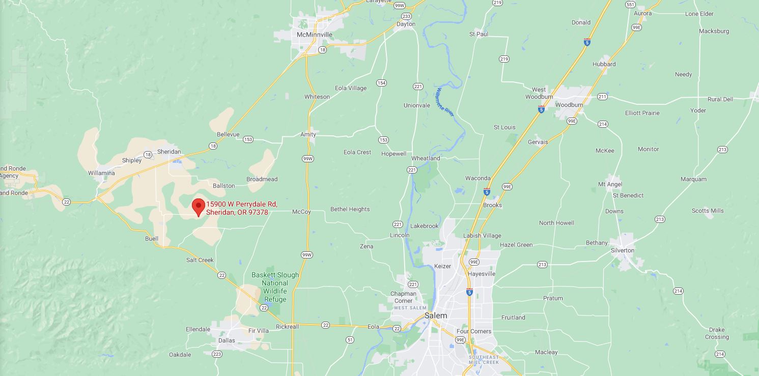
I can’t say ALL roads lead to Perrydale Trails, but as you can see by the map, many actually do.
Here are our recommended directions. We’ve lived here for 33 years, and these are the safest, quickest and best for hauling with a horse trailer. They aren’t necessarily the ones Google or Mapquest say to use. But, we know what works.
From Salem
~Be in the left lane as you cross the Marion St. Bridge
~Follow Hwy. 22 for 7 miles.
~Turn right at the 99W Intersection and head north 7 miles
~Turn left at the 99W/Bethel intersection (also says McCoy/Perrydale)
* * Your GPS will tell you to use Red Prairie Road but you will be backtracking. And, sometimes it will send you down several miles of gravel on Enterprise Road. Follow my directions!
~From the McCoy/Perrydale intersection, it is seven miles west to our place
~You’ll pass by the Perrydale School; stay straight. The road name changes to W. Perrydale Rd.
~The road is paved and changes to gravel. There are several sharp corners and we’ll be the first place on the left after the turns.
~Our address is basically a straight shot from 99W. It’s all farmland out here and we sit on a hill, so you can see our place from a long way off.
~Don’t turn on any side roads, and you’ll soon be here.
~Look for three big green buildings, a huge American flag proudly waving, and our Perrydale Trails driveway sign.
From Newberg (99W)
Two Ways
#1)
~Follow signs to the Oregon beaches on Hwy. 18.
~After McMinnville, stay on Hwy.18 for 8.5 miles.
~Turn left onto Christensen Rd., go about ½ mile, turn right onto DeJong Rd.
~Stay on this road for 4 miles (you will pass through Ballston). DeJong Rd. intersects with W. Perrydale Rd.
~Turn right and go 2 miles to Perrydale Trails.
(see below for the rest of the directions)
#2)
~Follow signs to the Oregon beaches on Hwy. 18
~At McMinnville, take slight right onto ramp to access Hwy. 99W
~Turn left onto Hwy. 99W and go through Amity
~Continue south on 99W for five miles from Amity
~Turn right onto Bethel Rd. (yellow blinking light)
(see below for the rest of the directions)
Rest of directions for both #1 & #2:
~From 99W/Bethel intersection, it is seven miles west to our place.
~You’ll pass by the Perrydale School; stay straight. The road name changes to W. Perrydale Rd.
~The road is paved and changes to gravel. There will be several sharp corners and we’ll be the first place on the left after the turns.
~Our address is basically a straight shot from 99W. It’s all farmland out here and we sit on a hill, so you can see our place from a long way off.
~Don’t turn on any side roads, and you’ll soon be here.
~Look for three big green buildings, a huge American flag proudly waving, and our Perrydale Trails driveway sign.
From Corvallis heading North
~Heading north on 99W, go through Rickreall and after crossing over Hwy. 22, travel 7.5 miles.
~At the flashing yellow light, turn left onto Bethel Rd. (Also says Perrydale/McCoy)
~From 99W/Bethel intersection, it is seven miles west to our place.
~You’ll pass by the Perrydale School; stay straight. The road name changes to W. Perrydale Rd.
~The road is paved and changes to gravel. There are several sharp corners and we’ll be the first place on the left after the turns.
~Our address is a straight shot from 99W. It’s all farmland out here and we sit on a hill, so you can see our place from a long way off.
~Don’t turn on any side roads, and you’ll soon be here.
~Look for three big green buildings, a huge American flag proudly waving, and our Perrydale Trails driveway sign.
From the Coast on Hwy 18
~Turn right on Red Prairie Rd. just before the Sheridan exit. Follow for 3.5 miles.
~Turn left onto Blanchard Rd. (gravel).
~Stay straight onto W. Perrydale Rd. Go two miles.
~We are at the top of a hill on the right.
~Look for the Perrydale Trails sign on the driveway.

